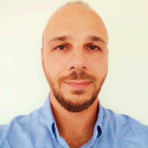
Christodoulos Mettas
Christodoulos received his undergraduate degree from the University of Nottingham, where he obtained the degree of MEng (Master of Engineering) Honours in Civil Engineering. His postgraduate degree was a Master in Science degree (MSc) from the CUT on Civil Engineering and Sustainable Design. He is working as a Researcher at “ERATOSTHENES” Research Centre at CUT and is Managing EU projects.
His research interests concern the Integration of remote sensing, UAV techniques for road maintenance, Spectral Signatures, Remote Sensing and GIS for environmental applications, Maritime Spatial Planning, Surface water quality monitoring of inland & coastal water bodies, Natural disaster management, Risk Disaster Management.
Moreover, Christodoulos participated in the following projects:
- Project manager on “Cross-Border Cooperation for Implementation of Maritime Spatial Planning” referred as “THAL-CHOR 2” which is a Cross-Border Cooperation for implementing Maritime Spatial Planning in Greece and Cyprus- INTERREG V-A
- Project manager on “Digital Aposphragisma (Imprint) of Hagionymous Islands” which concerns the Navigation of Cultural Heritage Digitization of Churches of Cyprus and Crete- INTERREG V-A
- Researcher on a European Space Agency (ESA) project, namely, SOFIA - "Schools’ encouragement in educatiOn and outreach oF Earth surveIllance And remote sensing"
- Expert advisor on the National Risk Assessment of Cyprus (tender through Cyprus Civil Defense),
- Expert advisor on the evaluation of Phase III - Strengthening Disaster Risk Management Capacities in Lebanon which is a United Nations Development Programme (UNDP) tender
- Researcher in ATHENA project (Remote Sensing Science Center for Cultural Heritage) funded by the H2020-TWINN-2015,
- Researcher in DECATASTROPHIZE (Use of SDSS and MCDA to prepare for disasters or plan for multiple hazards) funded by DG-ECHO and
- Researcher in THAL-CHOR (Marine Spatial Planning in Cyprus) funded by INTERREG IV.
Finally, he worked in the construction industry and particularly was managing Solea’s Dam construction in Cyprus (budget ≈ 20 million Euros). He is, also, a member of the Cyprus Scientific and Technical Chamber (ETEK).
- Mettas C., Neocleous K., Agapiou A., Themistocleous K., Hadjimitsis D.G. and Michaelides.,S, Risk provision using field spectroscopy to identify spectral regions for the detection of defects in flexible pavements, Special Issue of Natural Hazards, "Applications of Geoinformatics for the Prevention and Mitigation of Natural Hazards" ,2016
- Hadjimitsis D.G., Agapiou A., Themistocleous K., Mettas C., Evagorou E., Soulis G., Xagoraris Z., Pillikou M., Alliouris K., And Ioannou N., Marine Spatial Planning in Cyprus, Open GeoScience, 2016
- Damalas A., Mettas C., Evagorou E., Giannecchini S., Iasio C., Papadopoulos M., Alexandra K., Hadjimitsis D.H, Development and Implementation of a DECATASTROPHIZE platform and tool for the management of disasters or multiple hazards, International Journal of Disaster Risk Reduction, 2018
- Evagorou E., Mettas C., Agapiou A., Themistocleous K., Hadjimitsis D.G., Bathymetric maps from multi-temporal analysis of Sentinel-2 data: the case study of Limassol, Cyprus, Advances in Geosciences, 2018
- Mettas C., Agapiou A., Themistocleous K., Neocleous K. and Hadjimitsis D.G., Detection of asphalt pavement cracks using remote sensing techniques. In Edinburgh International Conference Centre, Edinburgh, United Kingdom, 2016